Two Great Walks at Camden Hills State Park
Full disclosure: I suck at hiking. I can walk for hours and log miles, but throw in any kind of elevation, rocky and root-filled paths, and blazes to follow, and I’m a bit of a mess. I have a really poor sense of direction, and I’m just not a confident hiker.
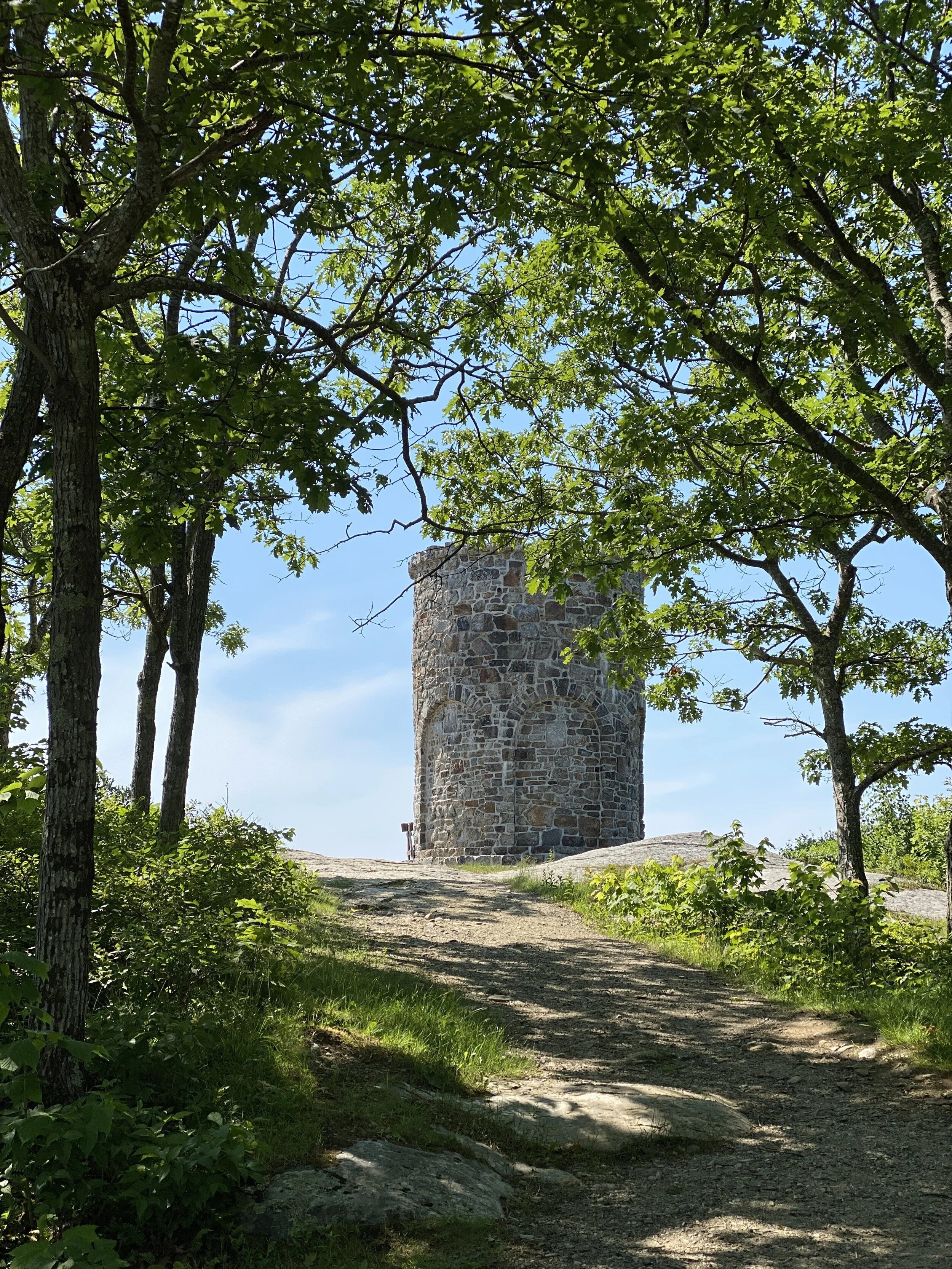
During our recent camping trip to Camden Hills State Park in Camden, Maine, I really wanted to go to the top of Mount Battie and check out the stone tower, the Mount Battie War Memorial, that sits atop the 780’ peak and overlooks Camden Harbor and Penobscot Bay. There are a few trails that leave from the park, the most popular being the Mount Battie Trail, a 1.1 mile out-and-back trail that’s considered “moderate.” Could I do it? Probably. But G? Probably not. Due to his severe anemia right now, a result of his declining kidney condition, he can’t really exert himself much, So, not trusting myself to navigate even this short hike solo, I decided I’d walk up the auto road (yes, you can drive to the top of Mount Battie!), and G would drive to meet me at the top. Perfect!

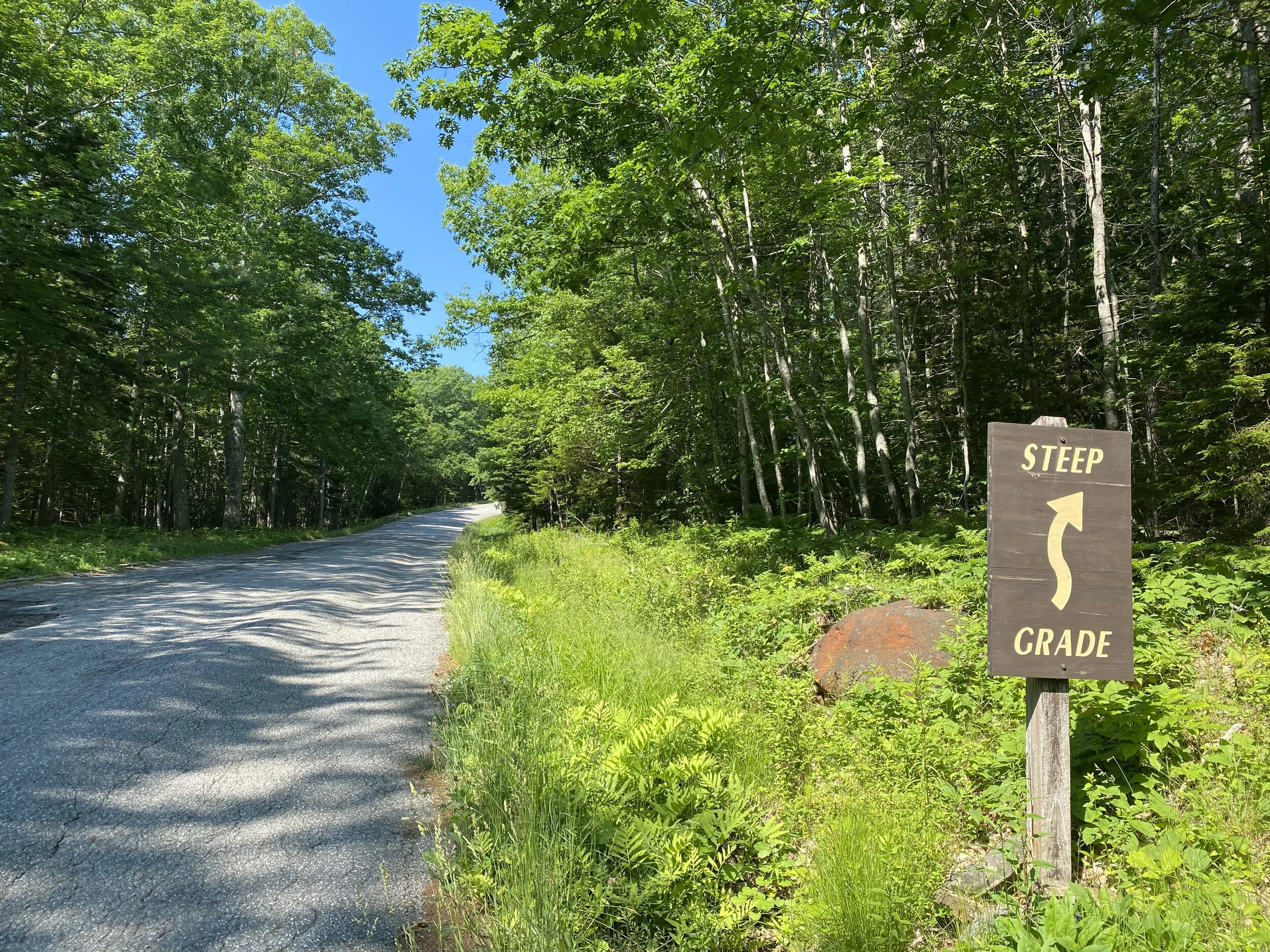
The 1.6-mile road was constructed in 1963; I learned from this webpage that a hotel, Summit House, once stood on the summit. The stone tower now stands in that location and is dedicated “In grateful recognition of the services of the men and women of Camden in the World War, 1914-1918.” The entrance to the auto road is just past the toll gate inside the park and not far from our campsite (#99). The use of the road and trails are included in the fee for campers; the cost for a day-use pass to access the park is $4 for Maine residents and $6 for nonresidents.
One of the pros of this route to the summit is that I had the road to myself—plenty of physical distance to be had! I passed only one group of walkers—a family of four—making their way down and a few cars. Other than that, pure quiet (except the sound of my heavy breaths!). I’ll be honest: the walk up the auto road wasn’t exactly a breeze for me—in fact, I had to stop a few times just to catch my breath. And while it only took about a half-hour, there was an elevation gain about 555 feet over that half hour—for this living-at-sea-level-girl, my lungs felt it. Just take a look at those those dips in the blue line of the graph below; that’s me, stopping to get my heart rate (red line) under control!! And yes, my heart rate runs really high; that’s “normal” for me!


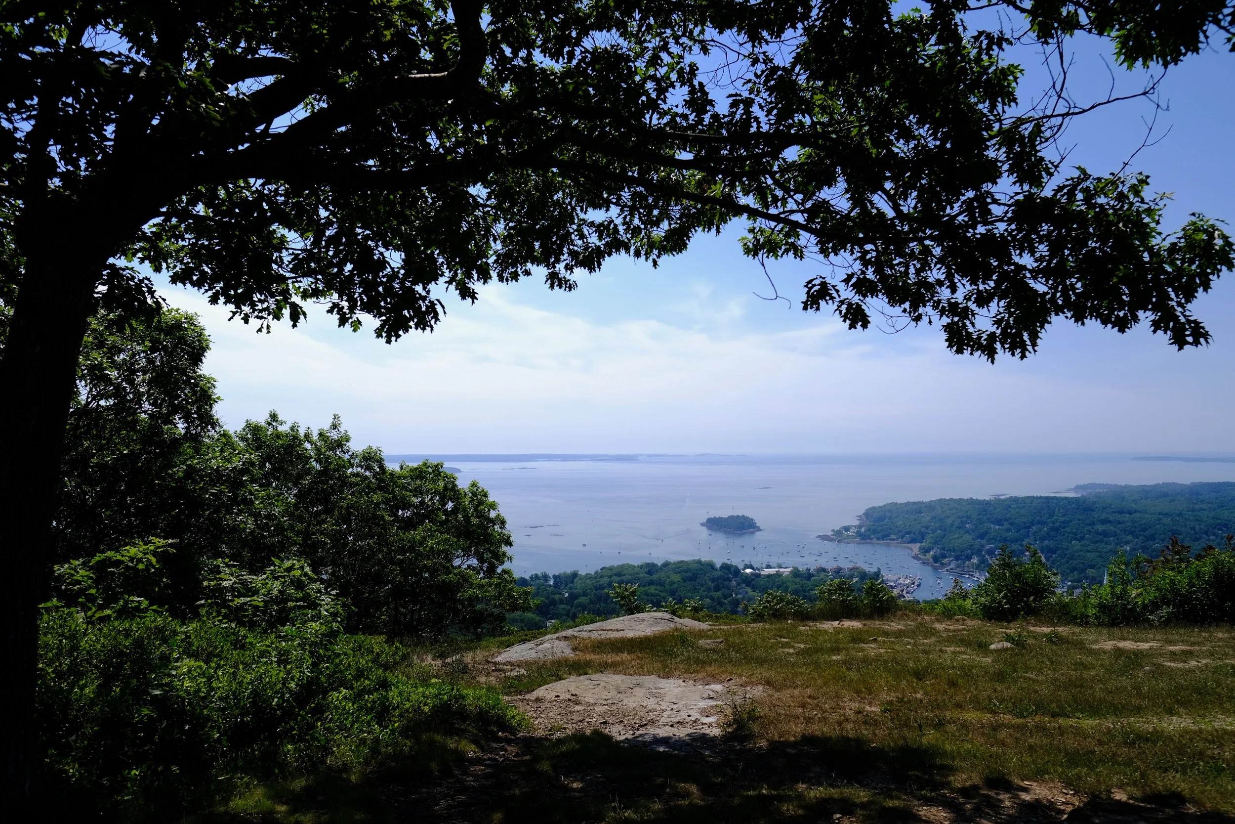
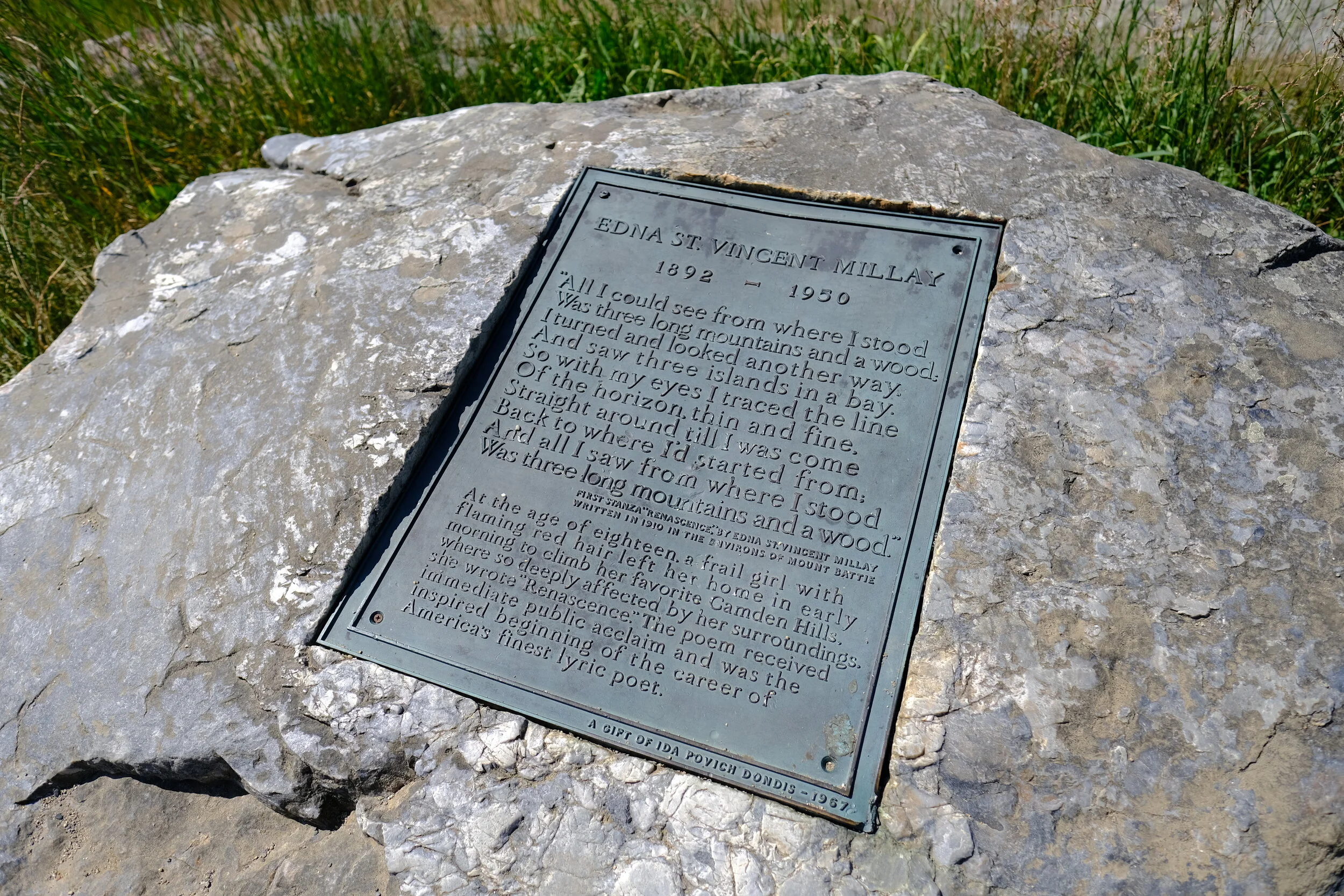
It took me just under 40 minutes to get to the top; I promptly sat down and waited until I saw the van summit, and then G and I took in the view—it really is a gorgeous one. The summit has a bit of a Cadillac Mountain summit feel; located in Acadia National Park, Cadillac is the highest point on the Atlantic seaboard and looks out over the Porcupine islands in Frenchman Bay. Mount Battie looks out over Camden Harbor and Penobscot Bay. The view is said to have inspired the Edna St. Vincent Millay poem “Renascence,” the first stanza of which is immortalized on a rock atop the summit.


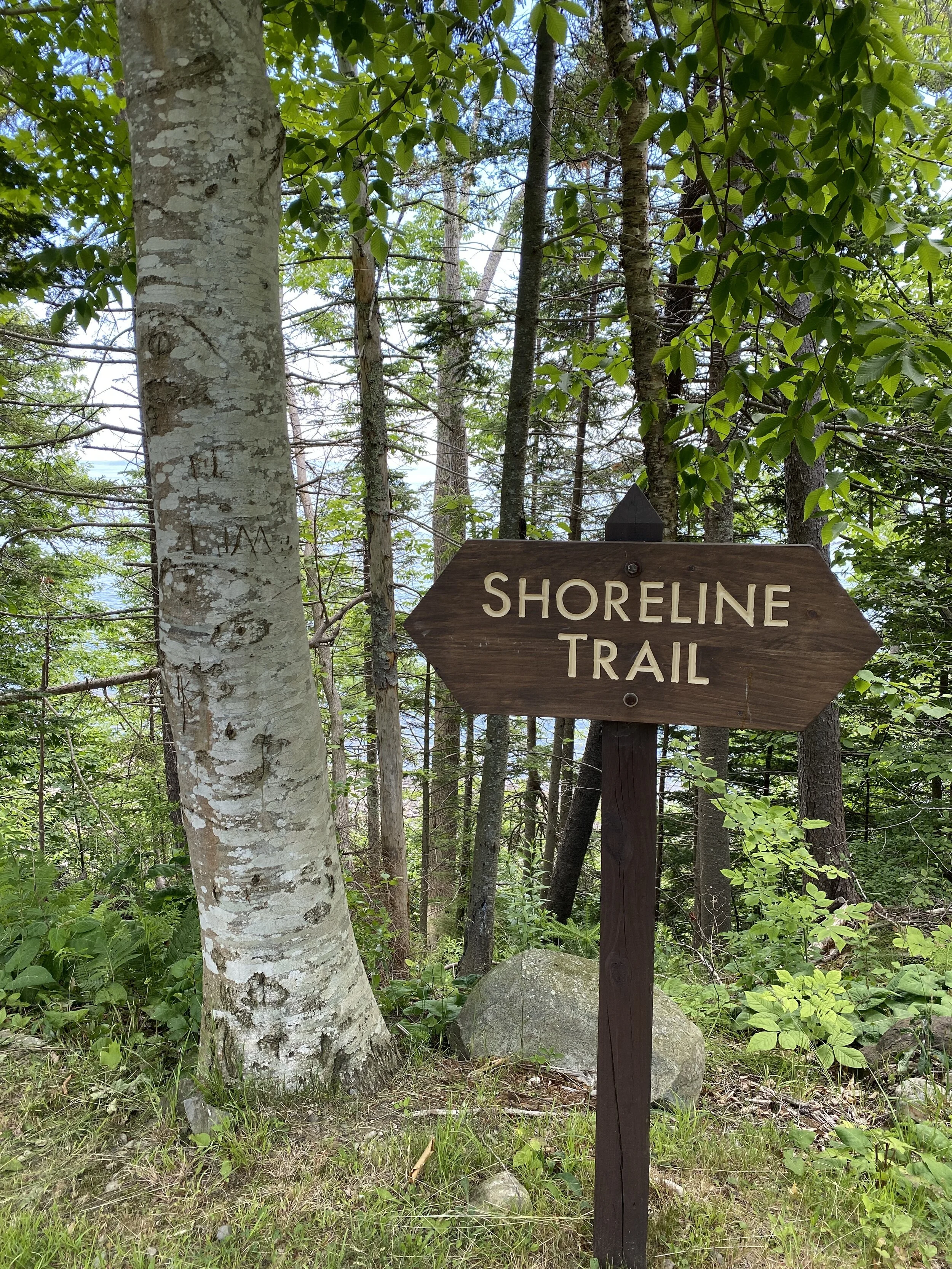
After snapping an obscene amount of photos at the summit, I decided to walk back down the auto road (all downhill!!) back to the campsite, which only took about 25 minutes while G headed back down in the van. Once back at the campsite, we decided to head across the street, to the other half of the park, to walk the Shoreline Trail.

Route 1 cuts Camden Hills SP down the middle; on one side is the campground, the Mount Battie auto road, and several hiking trails. On the other side is the group camping area, terrific spots for picnicking, and access to the Shoreline Trail.
The Shoreline Trail is 0.8-mile out-and-back trail that hugs the coastline and is rated “easy.”


The Shoreline Trail is incredibly scenic, and there are places where you can take the trail down to the rocks below. You could also simply park at any one of the picnic tables spaced along the trail and relax. There are grills accompanying each table as well, making for fantastic sites for a lunch or dinner away from the main campground and overlooking the water. And, of course, following the trails down to the water yield amazing views of the Maine coast.


These two trails offer some fantastic views; with the option to drive or walk the auto road or take one of the many other trails up Mount Battie, everyone can access the gorgeous views—the same is true for the Shoreline Trail. Round-trip on the auto road was about 3.2 miles; from our campsite to the Shoreline Trail and back to the campsite was just under 2 miles. Together, about 5 miles of walking/hiking. Not a bad way to spend a beautiful June morning! While there are plenty of more challenging trails from the park, we’re not looking for those kinds of trails—at least not at this point. If you are, be sure to check out the trail map and list of hikes available from the park’s webpage (links below) or check out the trails on the AllTrails site or the Maine Trail Finder page.
If you go:
Camden Hills State Park
Address: 280 Belfast Road / Camden, ME 04843
Entrance fees: $4.00 (Maine residents) / $6.00 (non-residents) / $2.00 (senior non-residents)
Maine residents over 65 are free; children 5 - 11 years old: $1.00; Children under 5 are free.
*NOTE: The Mount Battie Road, from Nov 1st to May 1st, may be closed based on weather and staffing.
List of other trails and trail map