Where the Woods Meet the Great Bay: Adams Point

On a rare off-weekend from camping, G and I decided to explore a nearby trail about 20 miles from home, the Adams Point Loop Trail in Durham, New Hampshire, located within the Adams Point Wildlife Management Area. At 1.5 miles, the trail is short and sweet, with terrific views along the way and what might be two of the best benches I’ve spotted on trails so far (more on those in a bit).
Initially, we weren’t sure of the best place to park, so we ended up following the road to the Jackson Estuarine Laboratory building, then turning around and parking closer to the boat launch and accessing the “trailhead” (really, just an opening in the woods across the street) from there. Jackson Estuarine Laboratory is part of the University of New Hampshire (whoo-hoo! Go Wildcats!) and “features well-equipped facilities where scientists conduct field-based and experimental research on physical and biological components of coastal ecosystems.” Cool. Just a note, though: parking for Adams Point is not allowed at the lab.
The trail isn’t marked with blazes, but it’s pretty easy to follow—unless you’re me; I kept turning to G and asking, “are you sure this is the right way?” Um, it’s a loop. As I’ve written before (and if you know me, you know this to be true): I have an awful sense of direction. The trail itself varies; at the start, the trail was full of exposed tree roots; then, it was little more than shale rocks scattered along the path. In those parts, I was overly cautious, as I don’t always trust my footing and my ability to navigate roots and rocks. Let’s just say I’m neither naturally graceful nor agile. Later, the trail became a cleared path through the lush landscape.


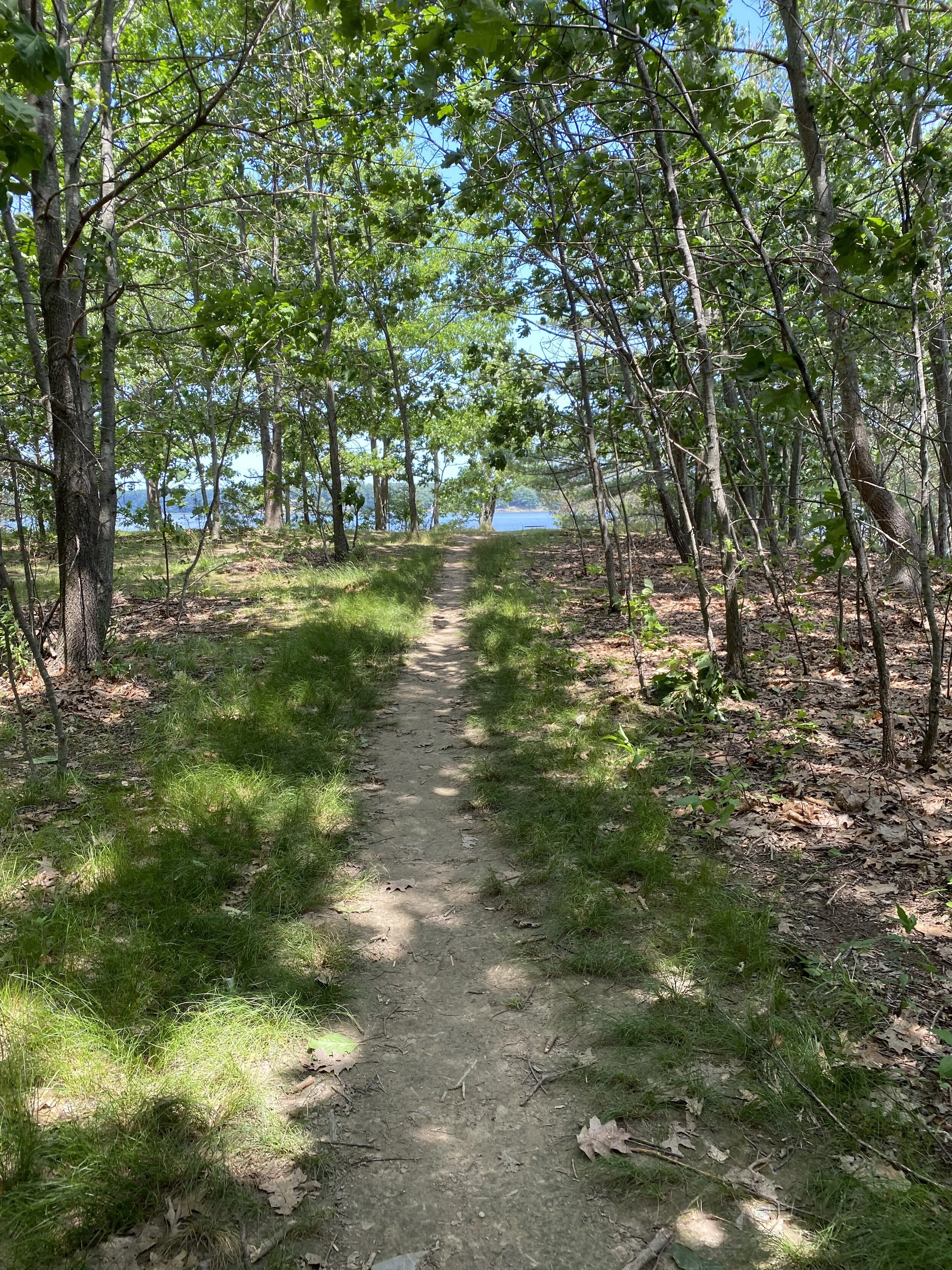

Keeping the water continuously to our right, I figured I wouldn’t couldn’t get lost (though I probably would have, without G!), and the views were pretty fantastic, even on this mostly cloudy day. Adams Point juts out into Great Bay, with Newington, NH, and the Great Bay National Wildlife Refuge (another location I hope to visit this summer/fall) just across the water. There’s a ton to explore within Great Bay, and my guess is that it’s one of New Hampshire’s hidden gems. Great Bay is a tidal estuary (an estuary is the tidal mouth of a large river) occupying more than 6,000 acres. Here’s a brief summary of Great Bay from the Great Bay National Estuarine Research Reserve:
Great Bay is a place where the ocean and rivers, land and water, and people and nature meet. It lies at the confluence of tidally driven salt water from the Gulf of Maine and fresh water from the Salmon Falls, Cocheco, Bellamy, Oyster, Lamprey, Squamscott, and Winnicut rivers. Before reaching the bay, seawater travels 15 miles inland—a geographic configuration makes Great Bay one of the nation’s most recessed estuaries. It is often referred to as New Hampshire’s “hidden coast.”
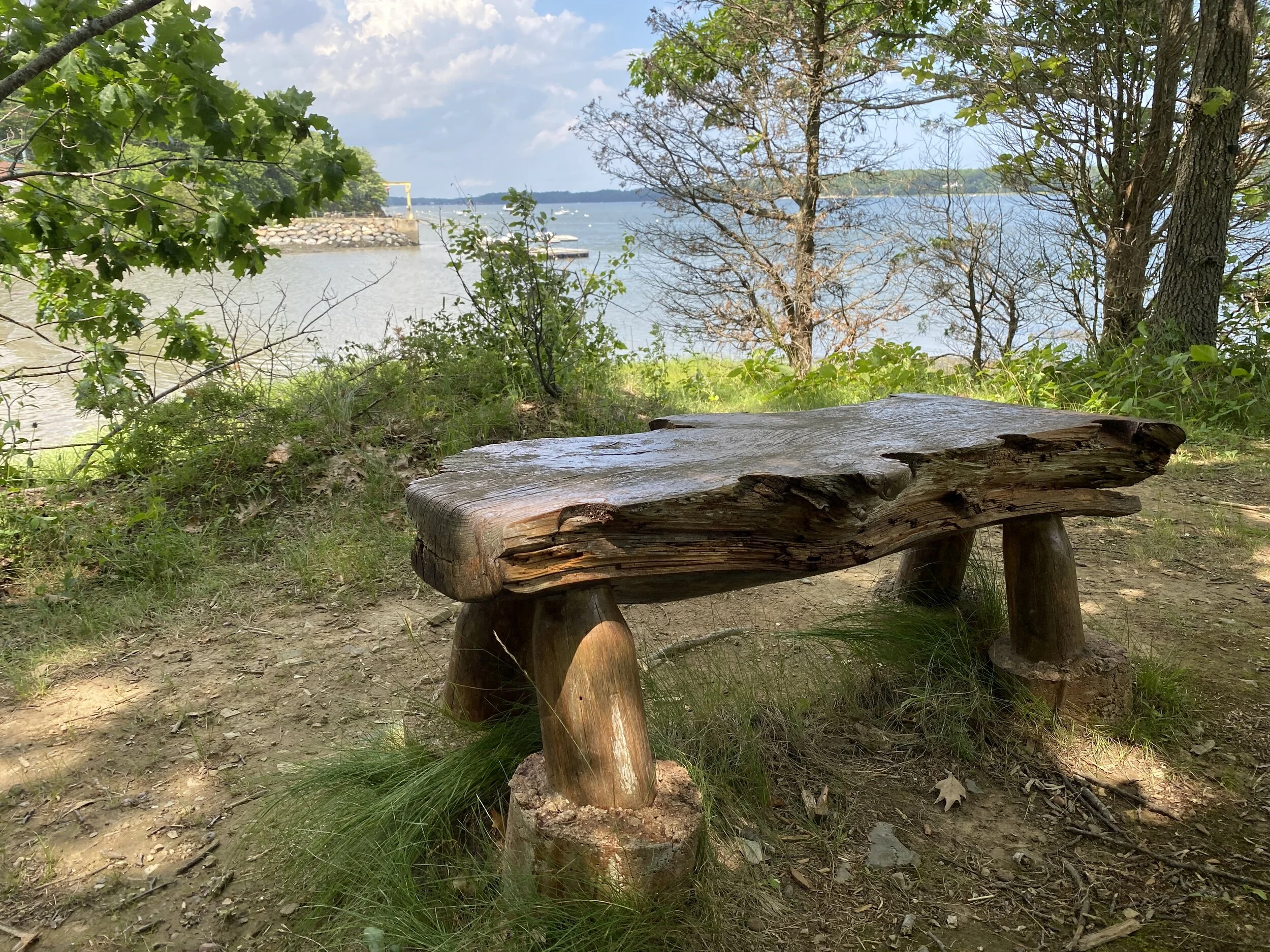
And if you’re a fan of water views, this trail has them aplenty—and even a few staircases spread throughout the trail leading down to the water.


The highlights of the trail, however (beyond the water views) might just be two of the best trailside benches I’ve seen. The first, made from iron and a boulder, is way more comfortable than it looks. And the second, hewn from a tree, is just as smooth and comfortable as it looks. Both provide great views in addition to peaceful and quiet places to sit.

We meandered back toward our starting point, stopping to snap a few pics of rusted iron farming equipment, abandoned in the woods by the stone wall—as if that total image doesn’t scream “New England.”


The weather was all over the place on this particular day; a coastal storm had been in the forecast, and the skies alternated between cloud-filled gray and blue. This trail would be incredible on a fall day, with the contrast of the foliage against the blue waters (note to self: come back in the fall!). We were thrilled to have the sun peek out, and by the time we made it back to our car, the skies were again darkening—and drops started to fall. But first—a few shots of the canoe that seemed to be positioned and waiting for a willing photographer. I snapped a few shots, dodged a few raindrops, and then, within minutes of a quick summer downpour. Great timing on our part!

Oops, I forgot to turn off Strava at the end of the walk, so ignore that stopping point! Our loop started and ended where that green marker is. Aaargh, it was one of those days!
If you go:
Directions: The Adams Point trail can be accessed off Adams Point Road in Durham, NH. You can type “Adams Point Boat Launch” in Google Maps and follow the directions to that point. There’s a lower parking lot by the launch and, a few steps further up, an upper lot. If you go too far and arrive at the Jackson Laboratory, you can simply turn around to park in one of the lots. The trail can be accessed across the road from the parking lots, though there’s no marked “trailhead.”
Notes:
The trail, while not difficult, is uneven in parts and would not be accessible for those with mobility issues or for some young children. Wear solid shoes, as I imagine parts of the trail could be/would be quite mucky after heavy rains or in early spring. Also, as the trail is a bit higher than the water and eroded in parts, be mindful of youngsters and careful of footing near the dropoffs down to water! Finally, be sure to take/wear a mask. While G and I found ourselves the lone travelers on the trail this day, the trail is rather narrow, making passing others at a safe distance difficult. So, be safe and be kind: wear a mask.